Share the post "Étape du Tour 2027: Route and Reconnaissance between Cluses and Les Saisies"
154 km, 4850 m D+ and five climbs between Cluses and Les Saisies: the 2027 Étape du Tour sets the tone. But the most difficult part isn’t necessarily visible on the profile! From the first slopes of the Colombière to the final effort in Bisanne, this route can offer you a magnificent day in the mountains… or make you pay for every ounce of energy expended along the way. We went to scout it out for you: here are the sections to watch out for, the moments to catch your breath, and the traps to avoid to arrive in Beaufort with legs still fresh. Because that’s where your Étape du Tour will truly begin!
By David Polveroni (text and photos)
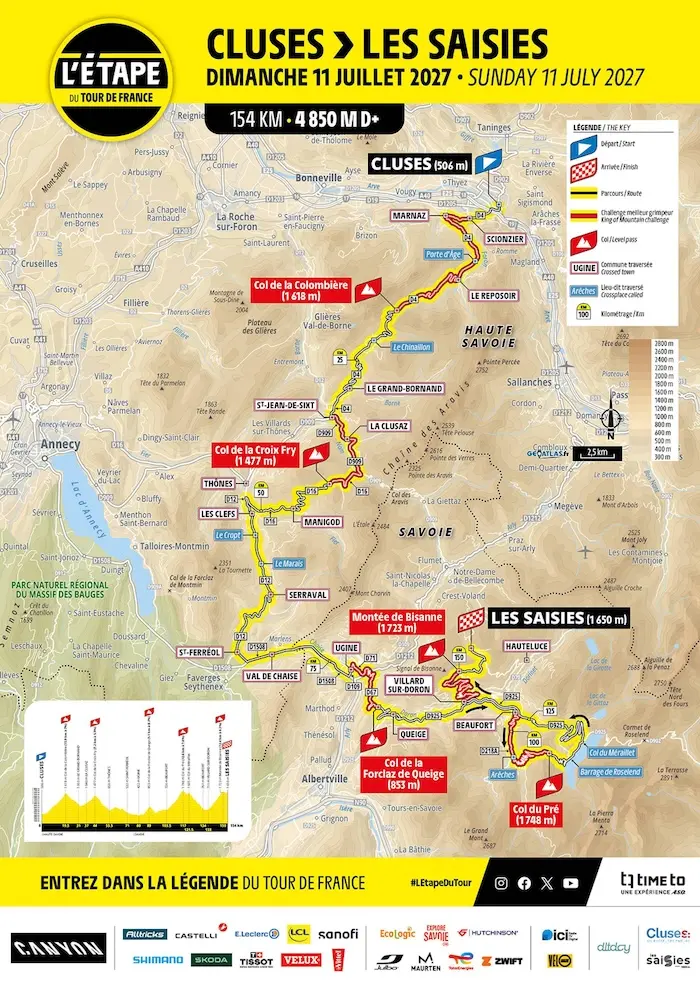
Cluses will host the start of the Étape du Tour for the first time. Professionals have already made it a regular stop, with three starts before 2027. Some of you may also remember passing through in 2018, on the Étape du Tour between Annecy and Le Grand-Bornand. We were then at the foot of the Col de Romme, before continuing with the Colombière. This time, we head directly to the latter via Scionzier.
The Colombière: a gradually increasing difficulty
The Colombière is 15.9 km at an average of 7% according to the announced profile. But behind this figure, there are two distinct parts and a final section that deserves all your attention.
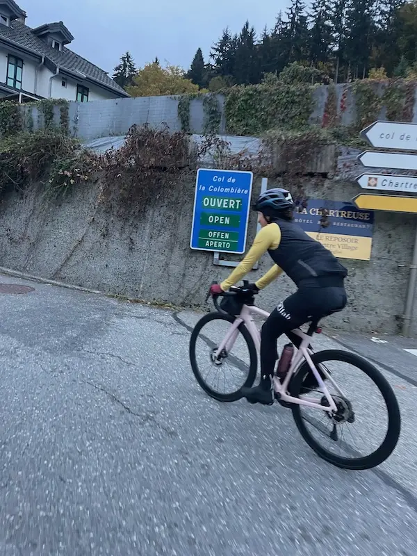
From Scionzier, the first slopes remain rather rolling, often around 5 to 7%, despite a few steeper sections. The road climbs to a flat section of over 2 km that takes us towards Le Reposoir. A village with a well-chosen name: enjoy this respite, because the exit marks a change of pace.
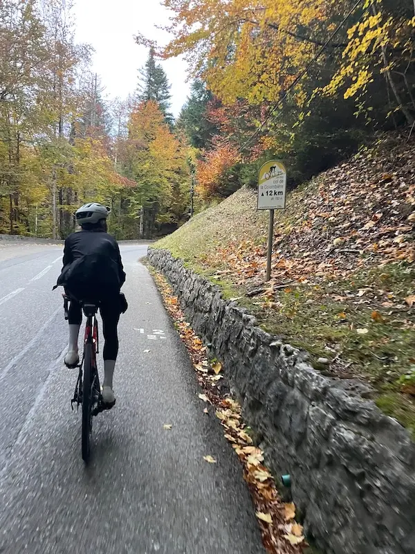
There are then about 7.5 km left to climb. The percentages increase, with some ramps already forcing you to shift gears. We gradually enter the most difficult part, up to the last three kilometers, and especially the last two, where the gradient leaves you little room to maneuver.
The chalet marking the summit can be seen from afar. You look at it, you get closer, but never fast enough! This long, exposed approach can seem endless when your legs start to struggle. Depending on your level and your pedaling style, a gear ratio between 36×30 and 34×34 will be very useful here.
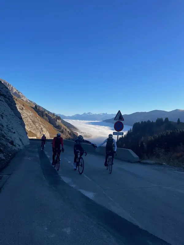
These slopes have witnessed some great battles of the Tour. In 2009, Alberto Contador and the Schleck brothers battled it out here before the finish in Le Grand-Bornand, on the stage that started from Bourg-Saint-Maurice. In 2021, Pogačar made a strong impression here, leading the peloton on the big chainring during the stage between Oyonnax and Le Grand-Bornand. For us, the gear ratios will be more modest!
The question remains how to approach this first section. If your main goal is to reach Les Saisies, the section up to Le Reposoir should serve as a warm-up. Find your rhythm, let your legs wake up, and keep in mind everything that awaits you afterwards. The ideal is to have a pre-established pace plan, with watts to maintain according to your abilities. This is the basic principle for this type of event, and something that can be prepared in training. The challenge is to stick to it on race day! With the excitement of the start, ego can quickly push you to follow a pace that’s too fast. Your legs respond, the group ahead seems within reach, and you’re already expending energy that will be missing in the Col du Pré or Bisanne.
At the front, the Colombière will undoubtedly be climbed very quickly. For those aiming for a fast time, it will require being able to sustain a significant effort from the start. Along with the Croix Fry, it will help form groups for the rolling sections that follow. Therefore, latching onto the right wheels can be beneficial, provided you know your limits. Because this is only the first climb of the day.
The descent to Le Grand-Bornand
The descent to Le Grand-Bornand presents no particular traps. However, be careful when crossing Chinaillon: the gradient softens and the road surface we encountered during our reconnaissance was not always in very good condition, with some deformations in the road.
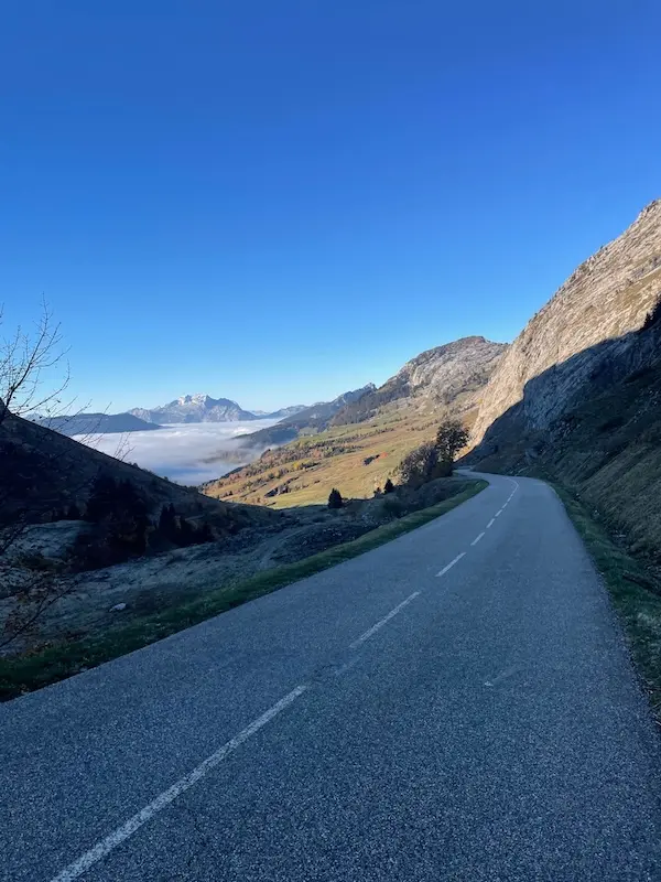
At the summit of the Colombière, at this time of year and if conditions are good, it should not be necessary to wear much extra clothing for the descent. This will obviously need to be adjusted to the weather on race day.
The Croix Fry: climbing without really climbing
At the bottom, we almost immediately get our legs going again with the short climb to the Col de Saint-Jean-de-Sixt. Around 6%, it will be swallowed up in a few minutes by the strongest riders. Enough to remind the legs that the descent is over!
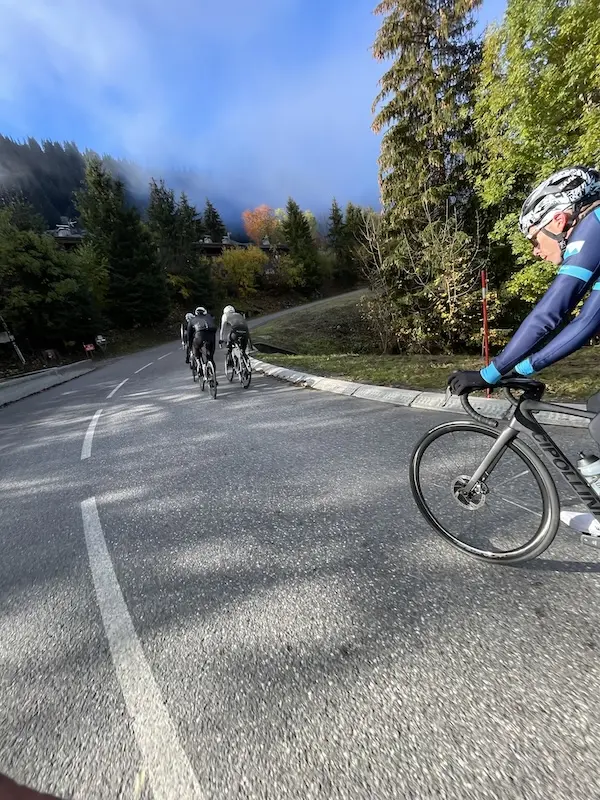
In Saint-Jean-de-Sixt, turn left towards La Clusaz. The road continues to climb, but without giving the impression of truly being on a pass. Sections around 3 to 6%, where you can still push a big gear and where speed differences can be surprising. For those racing, this part deserves attention: you’re climbing without really feeling like you’re climbing, but the watts, they are definitely there.
Around us, the Aravis mountains display their great limestone walls above the alpine pastures and chalets. The scenery is magnificent. After La Clusaz, we continue for a while towards the Col des Aravis before leaving its road to turn right, towards the Croix Fry.
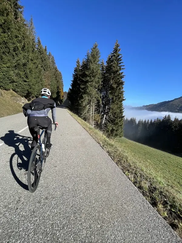
There are then about 4 km to the pass, with a descending section that breaks the effort before the ascent truly resumes. This time, you’ll have to drop to the small chainring. The gradient is steeper, with sections around 7 to 9%. The last 180° turn signals the final 800m: a last painful section before reaching the Col de la Croix Fry. The panorama opens up to the Aravis and the Tournette. On a reconnaissance ride, you can take a few moments to look around. In July, you’ll already have to think about the descent.
Descent of the Croix Fry
The first kilometers are steep, with a few hairpins that require good bike placement. We descend through meadows and chalets towards Manigod, with the Tournette in the landscape.
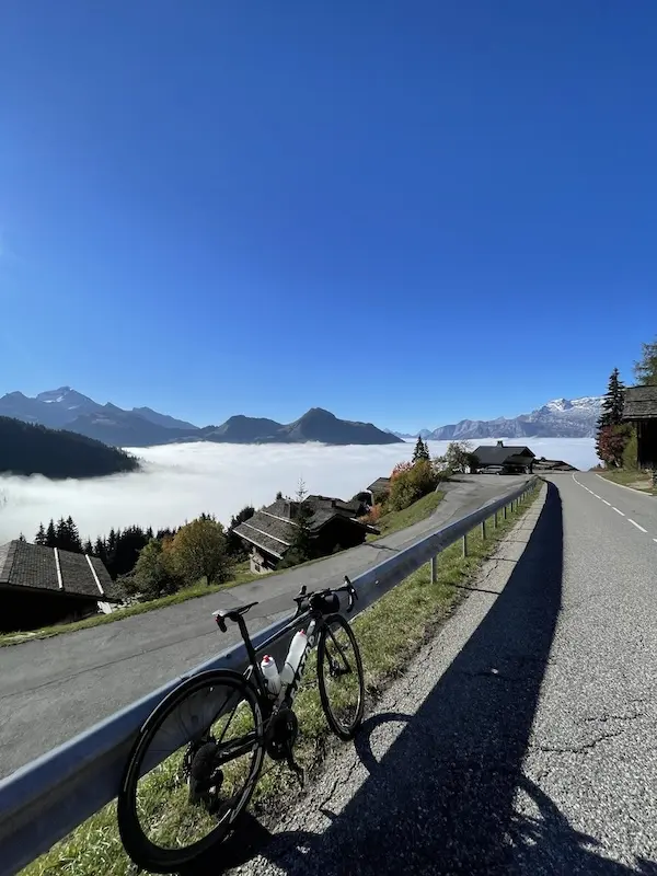
After the village, a flat section interrupts the descent before a second, straighter part towards Thônes. No particular traps to report on this section, but you must remain focused: your legs have already worked, and the day is still long.
The Col du Marais: don’t be fooled by appearances
In Thônes, a change of direction with a 180° turn to reach the Col du Marais. A small pass, at 843 m altitude, which could almost go unnoticed on the overall profile of the stage. However, this section can cost energy. The road first follows the Fier, then climbs towards Les Clefs and the Champfroid valley. We get that impression of climbing without really climbing, with changes in gradient, sections around 2 to 6% and a rhythm that is not always easy to find.
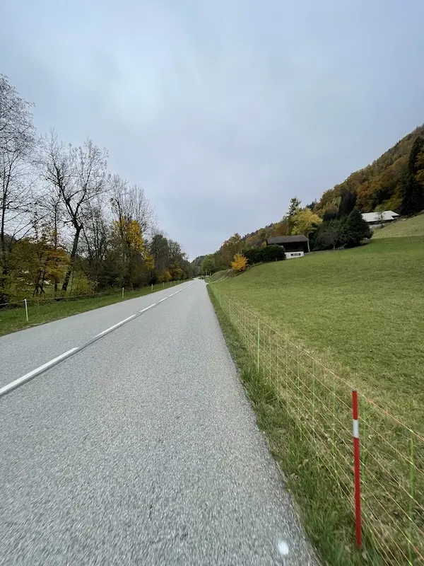
Ahead, this terrain can give the race several faces: attacks, accelerations, then moments when no one wants to take the wind. Depending on the conditions, the wind could indeed be a factor on this section. Changes in pace can hurt, even though the pass, on paper, seems almost insignificant.
For those who primarily want to reach Les Saisies, I would advise holding back. Conserve your strength and use this section to eat well. There are actually very few dead spots on this Étape du Tour, and you shouldn’t miss opportunities to save energy and refuel.
Serraval and Saint-Ferréol: an interrupted descent
After the Col du Marais, one might think that we will simply descend peacefully towards the valley. But an uphill section quickly intervenes as we cross Serraval. About 1 km of putting pressure back on the pedals: it’s not a major difficulty, but it still breaks the legs. We then head towards Saint-Ferréol. Beware of a few tightening corners: you need to maintain a safety margin in your lines and not get carried away by speed.
Here we find part of the roads from the last stage of the 2024 Tour de France Femmes avec Zwift, which started from Le Grand-Bornand to reach Alpe d’Huez. We remember the suspense until the last meters and Katarzyna Niewiadoma retaining her yellow jersey by four small seconds ahead of Demi Vollering, who won the stage.
The valley towards Ugine: groups will matter
In Saint-Ferréol, we reach the valley near Faverges, without going all the way to the town center, to head towards Ugine. The terrain becomes flat, even slightly downhill, and the groups formed in the first climbs will become very important here. During our reconnaissance, we took the cycle path. The race route, however, should follow the main road in this valley. This is a section to negotiate well before encountering the difficulties of the second part.
Ugine, at the foot of Mont Charvin, is also a town whose history was built around steelworks, developed in the early 20th century by engineer Paul Girod. But we are not yet at the end of our own day’s work!
Around kilometer 80, we briefly rejoin the start of the Côte d’Héry-sur-Ugine, used in the 2025 Étape du Tour. This time, we leave it after about 1 km to descend towards the entrance of the Gorges de l’Arly, before tackling the Col de la Forclaz de Queige.
The Forclaz de Queige: a watt factory
For me, this is a difficulty that many participants are likely to underestimate when looking at the route. The Forclaz de Queige is, however, 5.1 km at an average of 8.2%. A rather consistent climb, with sustained gradients from the very first meters. The road rises above Ugine and its factories. Here, you will understand the full meaning of the expression watt factory! You will have to produce power, and above all, still be able to sustain your effort after this first part of the race.
In my opinion, many things will start to become clear on this climb, at all levels. The management of the first ascents and the valley will be felt. If you’ve expended too much energy along the way, you risk starting to struggle. And this is just the beginning…
The Forclaz de Queige is a difficulty that many participants are likely to underestimate when looking at the route.
But let’s stay for now on this Forclaz de Queige. All the way to the top, you have to find your rhythm and maintain your effort. As you approach the summit, the gradient finally seems to soften a little, before leaving the Val d’Arly to reach the Doron de Beaufort valley. We are entering the Beaufortain region.
The descent to Queige is short, a little less than 5 km, and presents no particular traps. The first part is exposed, while the second has a few hairpins, with good visibility that allows you to read the turns well. We then reach the valley.
Towards Beaufort: a valley that requires vigilance
There are about ten kilometers left to reach Beaufort, which will mark the true starting point of the last part of this Étape du Tour. And it is especially this part that will make all the difference. But before that, you have to go up the valley. And it’s not a small, flat valley where you’ll simply be carried along by the group! Some sections climb sharply, to the point of making some riders drop to the small chainring on the first ramps. You still have to push on the pedals to reach Villard-sur-Doron.
At this point, a road on the left would allow you to directly join the climb to Bisanne, bypassing the entire loop via Beaufort and the Col du Pré. Geographically, the possibility of shortening the route is there. It remains to be seen what the organization will plan: one could imagine a time cut with a re-routing of competitors towards Bisanne, but this remains to be confirmed. Psychologically, this passage could also be a factor. For those who arrive already very tired, with insufficient preparation or a too generous first part, they will have to want to continue towards Beaufort knowing all that remains to be climbed. The road to Bisanne is there, on the left, but your route first passes through the Col du Pré!
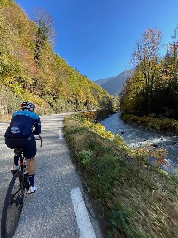
Another particularity: between Villard-sur-Doron and Beaufort, a section will be used in both directions. Some will still be climbing towards Beaufort while others will already be returning from the Col du Pré loop to reach Bisanne. Seeing competitors who have already overcome this difficulty pass by in the opposite direction could also affect morale. This will require, in my opinion, a significant organizational setup. One can imagine a separation of the two directions of traffic, as well as checkpoints on the Col du Pré loop. The details remain to be specified, but personally, from memory, I have never encountered this configuration on the Étape du Tour.
Once Villard-sur-Doron is passed and the Bisanne turn-off is left on the left, the last part towards Beaufort becomes more rolling. You can find a more regular rhythm before tackling the next section. In Beaufort, watch out for the cobblestones! They shake the bike quite a bit and require vigilance, both on this first pass and on the return, depending on the streets taken. Water bottles and equipment must be securely fastened.
The Col du Pré: serious business resumes
We then tackle the Col du Pré, already used on the 2025 Étape du Tour between Albertville and La Plagne. Many of you may therefore know this climb. But this year, it comes much later in the day: we are in the final, at the foot of the penultimate ascent, with already nearly 3,000 m D+ in the legs. The Col du Pré is 12.6 km at an average of 7.8% according to the ASO profile. And an average that hides a particularly difficult second part!
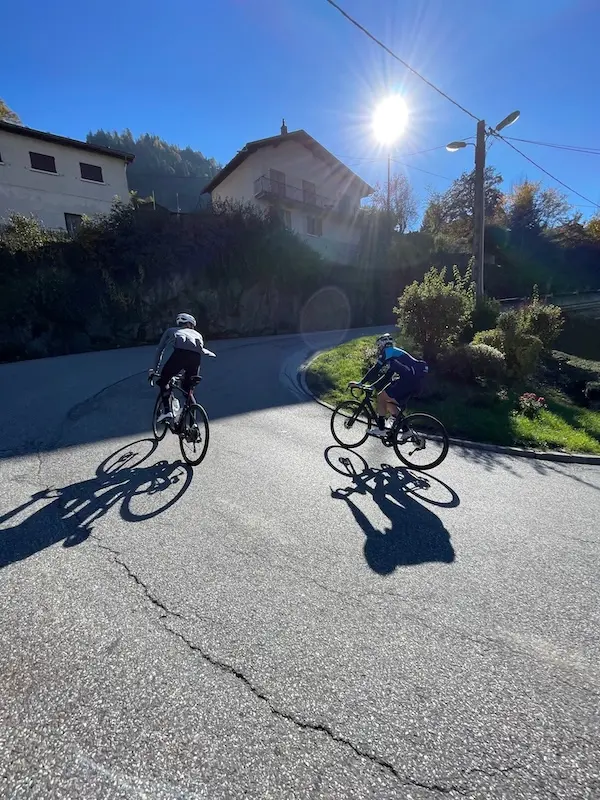
From Beaufort, the first large hairpins allow us to gain altitude above the village. The gradient is rather consistent, between 6.5 and 8% for the first 3.6 kilometers up to La Praz. We are already on a real climb, but we need to save some energy for what’s next. The road then softens as we approach Arêches. A more rolling section, then a short descent: this is a respite that will be appreciated to properly digest this first part before tackling the second part. The second part of this Col du Pré, but certainly not the easiest!
After Arêches, the percentages settle around 9 to 10%. Some sections are a little less steep, others a little more, but overall, there is very little respite. It’s consistently difficult. You have to find your rhythm and still be able to maintain it, with appropriate gearing… The switchbacks follow one another on this small road that climbs through the alpine pastures. Higher up, the sections between the hairpins lengthen, then comes that long final straight, the one where you really start to look forward to arriving. You look for the summit, you look ahead, you hope to see the gradient ease… Your legs, they know very well where they are!
And yet, this pass also deserves all your visual attention. You’re really not far from retinal cramp! The scenery is magnificent, even if your legs are likely to remind you that they too can quickly cramp up here. Those who were present in 2025 will find the same gradients and the same sun exposure. The Col du Pré hasn’t changed orientation since! In good weather, the heat can weigh heavily on this climb, especially at this stage of the day. In 2026, on the road to Alpe d’Huez, altitude was a major factor. Here, you’ll also have to contend with the heat, on this Col du Pré and, a little later, on the climb to Les Saisies. This is a parameter to take into account in your preparation and in managing your effort. Still, enjoy your surroundings to forget the suffering in your legs for a while. These landscapes are also why we ride here.
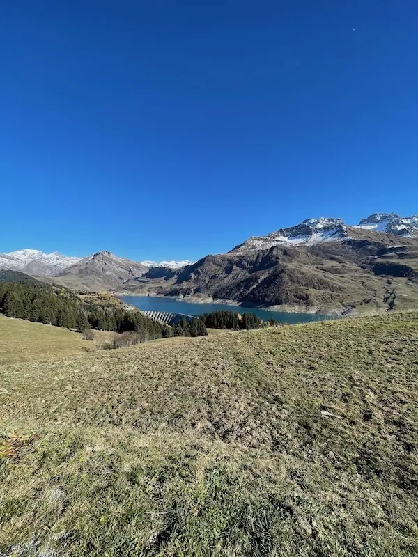
At the pass sign, at 1703 m, be careful not to think that everything is over: the road still climbs before the actual summit, with the event profile placing the high point at 1748 m. Those who did the 2025 Étape du Tour may remember this. The others are warned!
Roselend and Méraillet: still need to pedal!
A short descent allows us to reach Lake Roselend and its dam. The road we found during our reconnaissance was in rather poor condition. The hairpins present no particular surprises and this exposed section offers very good visibility. But it’s not yet a descent where you can truly rest. Immediately, you have to pedal again to cross the dam. The road is first flat, then a sharp kick reminds the legs that the effort is not over: about 200 m around 10 to 12% to reach the Col du Méraillet. It’s very short, but at this stage of the day, you feel it.
At Méraillet, around kilometer 121.5, the descent towards Beaufort truly begins. We find a more shaded road, with no particular traps. After the accelerations around the dam, we can finally let the bike roll and the legs rest a bit.
Back to Beaufort, before the last section
We return to Beaufort around kilometer 134. Again, be careful of the cobblestones in the crossing, before heading back towards Villard-sur-Doron. On this section already used on the way out, some competitors may still be on their way to Beaufort while you are descending towards the last ascent. About four kilometers separate us from Villard-sur-Doron, to prepare for the last major section of this Étape du Tour: the climb to Bisanne.
Bisanne: a final ascent that will count
For me, this is by far the most difficult access to Les Saisies. This mountainside has several roads, some of which are even steeper variants. We will take the main road from Villard-sur-Doron, with 12.4 km at an announced average of 8.3%. After all that we have just overcome, this is a figure that deserves all your attention! These figures are similar to the famous climb of Alpe d’Huez, but this time the beginning is easy… so a more difficult end!
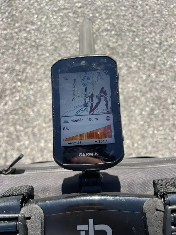
The beginning still allows a little time to settle in. The gradient gradually takes hold, then we find sections around 7 to 8%, interspersed with a few more rolling passages. However, don’t believe that the climb will give us much freedom. Because once the percentages are established, they are well established! In the second half, the sections around 9 to 10% become long, with very little respite. The gradient dictates the pace, and you still have to be able to keep up.
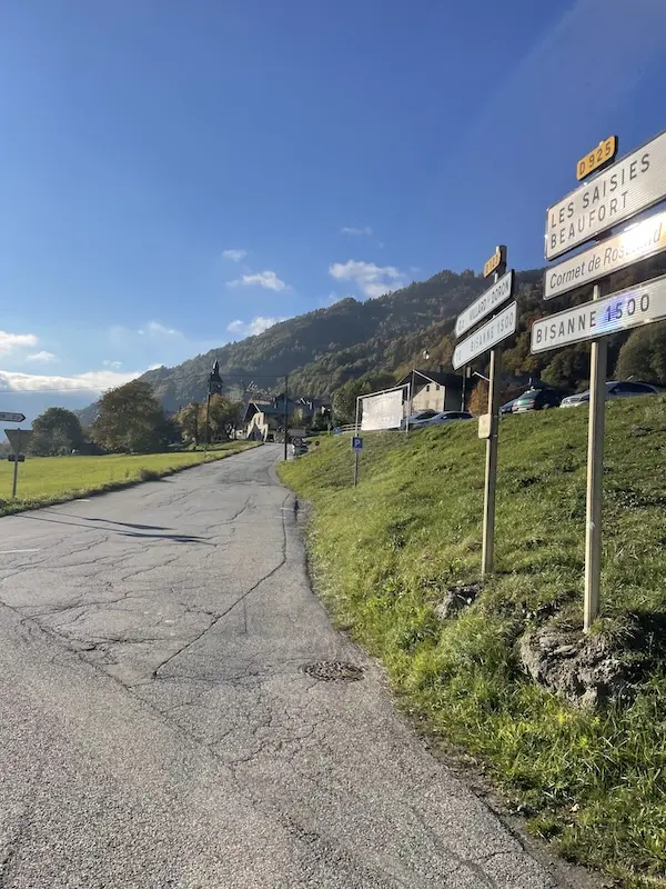
Bisanne 1500 will be a landmark, but certainly not the end of the difficulties. Above the resort, you still have to hold on to gradients close to 10%. This is where you’ll feel everything you’ve done since Cluses: managing the first passes, efforts in the valleys, energy spent following a group… or the energy you managed to preserve. In the final straight, the landscape opens up widely over the Beaufortain region. The alpine pastures plunge towards the valley, the peaks follow one another, with the distinctive silhouette of the Pierra Menta. The Mont-Blanc massif and the Aravis mountains complete this grand mountain scenery. Once again, your eyes have enough to momentarily forget what your legs are enduring!
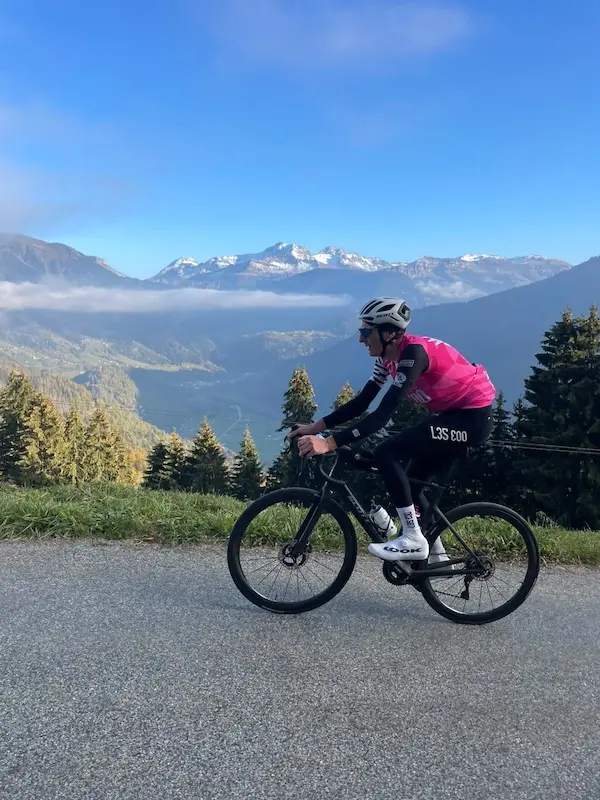
This final straight is particularly demanding. The gradient remains challenging, and the kilometers covered since Cluses remind you of themselves with every pedal stroke. But this time, you can start to give everything you have left. The last major section of your Étape du Tour is coming to an end. Or almost! The highest point of this climb is at 1723 m, around kilometer 150. There’s still a bit to go to reach Les Saisies.
Les Saisies: reaching the final meters
A short descent allows you to rejoin the main road leading to the Col des Saisies. A few moments to catch your breath, let your legs spin, and prepare for this final effort. At the roundabout, there’s about one kilometer of climbing left, on a gradient of around 5%. After Bisanne, this might almost seem easy. Almost, because with fatigue, this last kilometer won’t be done on its own.
These roads have witnessed some great stories of the Tour. In 2000, Marco Pantani chose the Col des Saisies to launch his long-range offensive on the stage between Courchevel and Morzine. For you, the story of the day is different: there are no more successive passes to conquer, but a few hundred meters to reach your finish line.
Les Saisies then reveals itself, with its chalets and residences spread out over this wide pass, where the Beaufortain and Val d’Arly meet. An open resort, surrounded by alpine pastures, where the gaze extends far. In winter, the ski slopes take over from our roads, and the local champions have long made these mountains known. We think notably of Franck Piccard, the child of the resort, Olympic super-G champion in Calgary in 1988. Les Saisies also hosted the cross-country skiing and biathlon events of the Albertville Olympic Games in 1992. Today, it is your legs that are writing their own little sporting history here.
This time, you have to give your last ounce of strength. You take your eyes off the computer for a moment, lift your head, and go for that line you’ve been waiting for since Cluses. The last turn, the last meters, and this whole day comes back at once: the Colombière at dawn, the first efforts, the Col du Pré, the heat, then Bisanne that seemed to never end.
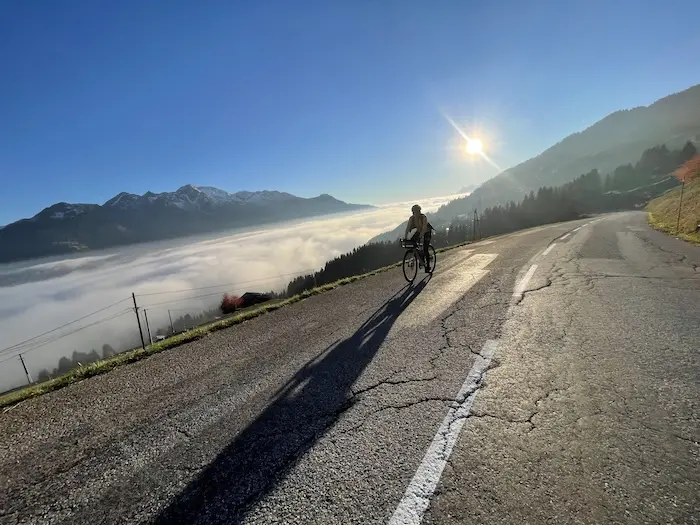
154 km and 4850 m D+ announced. You’ve reached the end of your Étape du Tour.
An Étape du Tour that will be decided by management
This edition remains well within the standards to which ASO has accustomed us. With 16 km and 550 m D+ less than the figures published for 2026, one might be tempted to see it as an easier day. But don’t be fooled by the numbers! The absence of a pass above 2,000 m and a vertical gain of less than 5,000 m D+ do not make this route insignificant. For my part, I even think it can become more difficult to manage than, for example, last year’s.
The entire first part, up to Ugine and even up to Beaufort, is tricky. The Col du Marais and the valley before Ugine are particularly sections where you can continue to expend a lot of energy without really realizing it. If you don’t take advantage of favorable moments to recover and refuel, fatigue accumulates. And it will be paid for dearly in the Col du Pré and the climb to Bisanne.
If there was one idea to keep in mind at the start in Cluses, it would be this: your Étape du Tour begins in Beaufort. Of course, you’ll have to get there first! But it’s with this last part in mind that you must approach the first ascents.
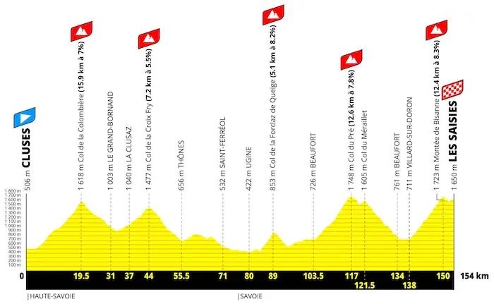
Depending on your goal and your level, you can allow yourself some more sustained efforts in the Colombière and the Croix Fry, or even short bursts into the red to latch onto a group. A group that can then save you time in the rolling sections of the Col du Marais and the valley towards Ugine. But you absolutely must not stay in that red zone! These are choices to prepare with your coach, based on your abilities and your race plan.
Durability will once again be essential: being able, after several hours, to exploit your first threshold, SV1, the top of your Z2, beginning of Z3, with as little degradation as possible. This, for me, is a fundamental quality on this type of course. Having the watts at the start is one thing; being able to maintain them in Bisanne is another.
Regarding gearing, I recommend a 50-34 chainring paired with an 11-34 cassette, to have at least a 34×34 in the difficult sections. Of course, the choice depends on each individual, their level, and their pedaling style. But you must be able to remain economical, even when the gradient steepens and your legs start to tire.
This economy is the guiding principle of your day. In terms of watts, changes in pace, and how you ride in a group: everything you can preserve before Beaufort will serve you in the final.
Link to our Strava activity for the reconnaissance: HERE

Share the post "Étape du Tour 2027: Route and Reconnaissance between Cluses and Les Saisies"