Share the post "Reconnaissance of the 2025 Étape du Tour between Albertville and La Plagne"
Albertville and La Plagne… Two iconic locations for cycling, mountain, and sporting achievement enthusiasts, where the Olympic spirit of Albertville meets the majesty of La Plagne’s snowy slopes. Between these two points, a stage awaited by all, a route carved into the rock of the Alps, which will challenge even the most seasoned cyclists on July 20, 2025. I embarked on this adventure for you, to scout every turn, every climb, and every panorama that will transform this stage into an unforgettable memory.
By David Polveroni – Photos: ©Julien Berard / ©David Polveroni / ©A.S.O.
The start will be given in Albertville, on Rue du Commandant Dubois. Here, the excitement will be palpable, bikes ready to roar, and thousands of cyclists will await the gun to set off. Immediately, we will cross the city along the Arly, a gentle 13 km warm-up to Ugine, without difficulty. This private road, just for the participants, will already give you a feeling of escape…
To register starting November 6, 2024: it’s HERE
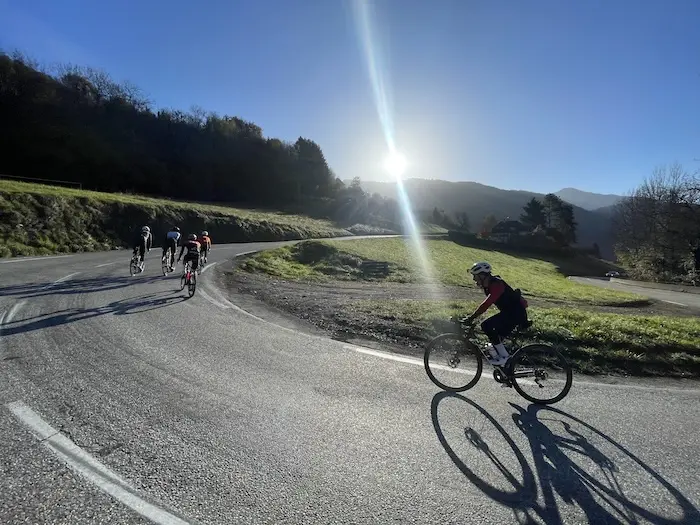
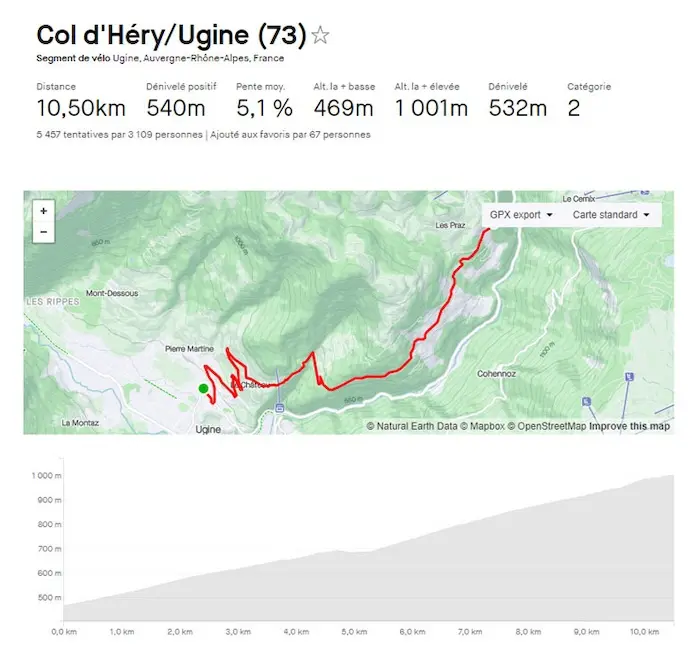
But the Étape du Tour will truly begin at the exit of Ugine, with the first climb, the Côte d’Héry. It is gentle and regular, around 5%, but already the legs will start to work and the competitive spirit will set in. The first switchbacks of the climb reveal the wild beauty of the heights of the Arly gorges.
No time for photos in July; the seemingly modest gradient will already encourage you to push yourself, to keep an eye on the cyclist in front of you, and ego will push everyone to give their all, even if it means going out a little too hard. This climb is a first test run, 5% over 5 km, a short 500 m respite downhill, then a series of 5 km around 6%, irregular and varied. It goes from 9% to flat sections at 3%, forcing everyone to play with their derailleur and maintain their rhythm.
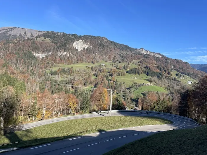
The descent that follows takes place in the heart of the Arly gorges, a series of wide curves, where the challenge will be to master speed, risks, and the desire to relax… Because after these 3.5 km of descent, we resume the ascent without transition to tackle the climb towards Crest-Voland and the Col des Saisies.
The Col des Saisies, first real test
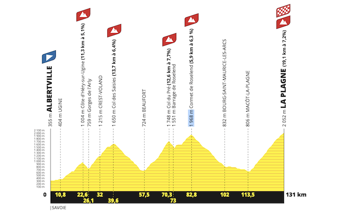
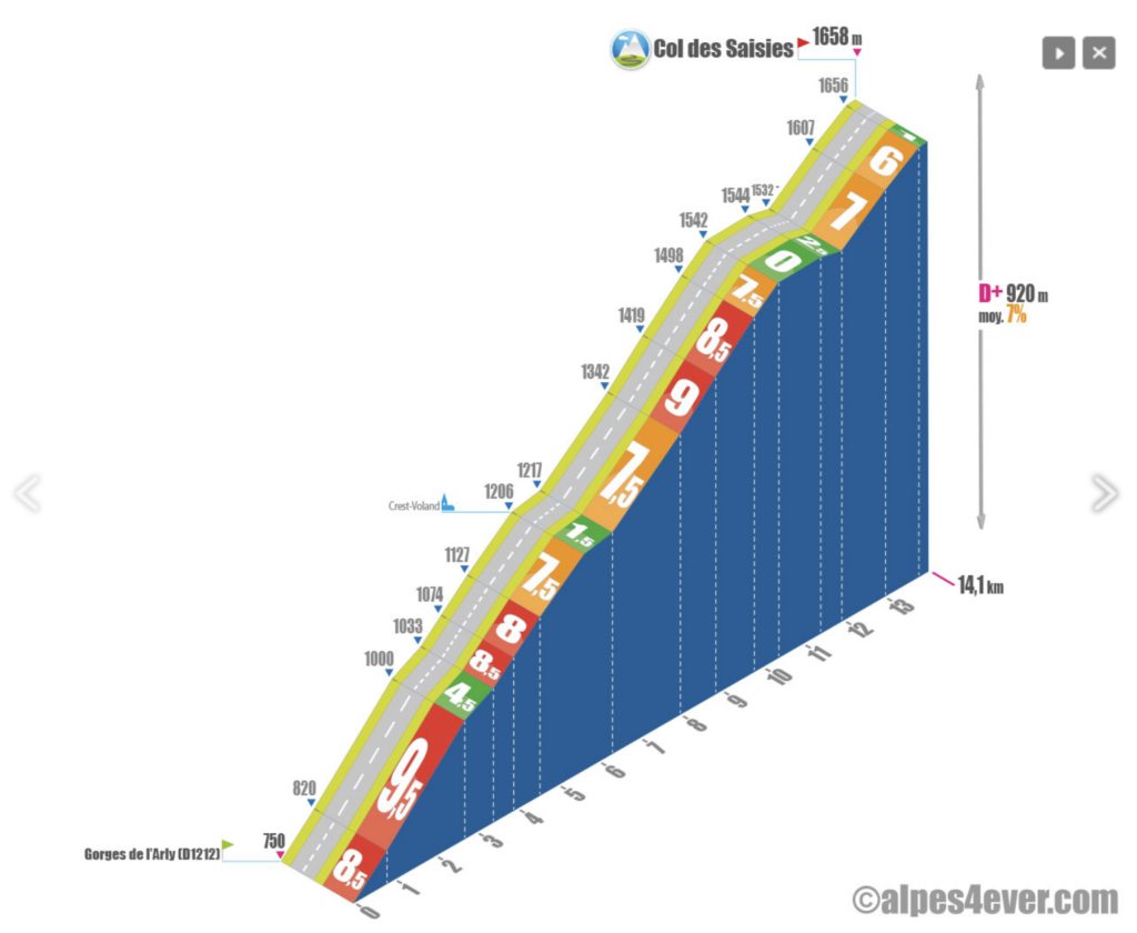
The climb of the Col des Saisies is the first real test. With its 13.7 km, it is divided into three distinct segments. The first part winds through the woods for 6 regular km between 7 and 8%, offering a constant gradient that helps to find one’s rhythm. The crossing of the village of Crest-Voland provides a welcome respite, time to catch one’s breath halfway up, with 430 m of elevation already swallowed.
There is still as much left, but this time over 1.5 km more, with percentages oscillating between 7 and 9% and flat sections that break the rhythm. The open turns and the last three hairpins offer a glimpse of the summit; this first springboard at 1650 m is crossed!
The descent towards Beaufort is fast. Here, the road bears the marks of winter, and in places, it can surprise with its condition. Over 13.5 km of descent, vigilance is essential. Compared to the Col de Braus, Les Saisies offers space and fluidity for refueling, a luxury not to be missed in 2025…
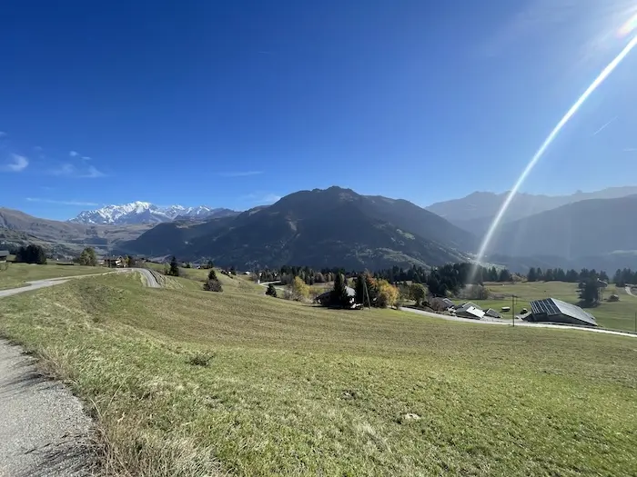
Technical sections are rare, but beautiful curves punctuate the descent, under the gaze of the surrounding peaks. Just before entering Beaufort, the scenery changes, and we enter the Beaufortain, an authentic valley rich in cycling history and Alpine traditions.
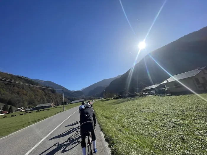
The crossing of Beaufort is not easy with its cobblestones; it highlights the importance of good equipment, with water bottles securely fastened to avoid surprises on this “bumpy” ground.
Those who were not yet fully awake will be at the foot of the Col du Pré, an unknown but formidable climb, which marks the first threshold towards the mythical Cormet de Roselend, the second giant of this stage.
The Col du Pré, an elevator to the Cormet de Roselend
The Col du Pré is the key to this stage. Little known but oh so formidable, it is the alternative to reach the Cormet from the north. From Beaufort, the tone is set: a 12.6 km climb with nearly 1000 m of elevation gain, for an inclination ratio of 7.7%, much harder than it seems.
From the first pedal strokes, the gradient settles between 6.5 and 8% up to the hamlet of La Praz. It is only upon arriving in Arêches that the climb softens for a moment, with 900 m at 4.5% and a short 400 m descent. But this break is brief: the gradient picks up again, sometimes reaching 9.5% in narrow and numerous turns, nearly fifteen in total. The Tour passed here in July 2018 on a stage with a similar profile connecting Albertville to La Rosière.
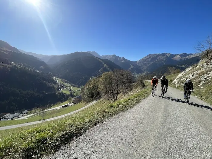
Arriving at 1,703 m altitude, after 12.2 km of effort, with the sign indicating the pass, one would think the climb is over, but a final surge remains to be overcome: 270 m at 8% then a final 465 m at 2% to reach the official time trial parking.
The view here is sublime, Lake Roselend below, its turquoise waters contrasting magnificently with the snow-capped peaks. A breathtaking landscape, a reward for those who have just tamed this ascent.
The Cormet de Roselend, a legend
After this summit, a short descent leads you to the Roselend dam, but be careful, it hardly allows for relaxation; between the narrowness of the road and the turns, it is better to stay focused. A break is necessary for those who take the time to admire, because the scenery is splendid, worthy of a postcard.
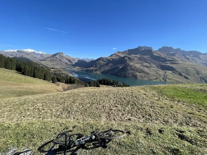
The climb resumes for a few hundred meters with an 8% gradient, then another 200 m at 12% to reach the Col de Méraillet and its well-deserved refreshment point. A fountain on the left can be used in case of an overcrowded aid station. Before tackling the last 6 km of the Cormet de Roselend, a lull sets in, and Lake Roselend appears in the background.
This is the time to savor the view, to take a gel or a bar to recharge your batteries, and to relax your already tired muscles.
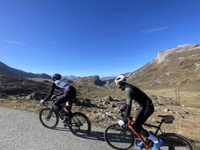
The last section of the Cormet is gentler, 6 km at an average of 6%. Here, the altitude is felt and the legs, already tired, feel every meter of elevation gain. The panorama is breathtaking; at the Rocher du Vent, we leave behind Lake Roselend and its sparkling waters.
The Beaufortain valley recedes, and the landscape gradually transforms into high mountains as we approach the Tarentaise.
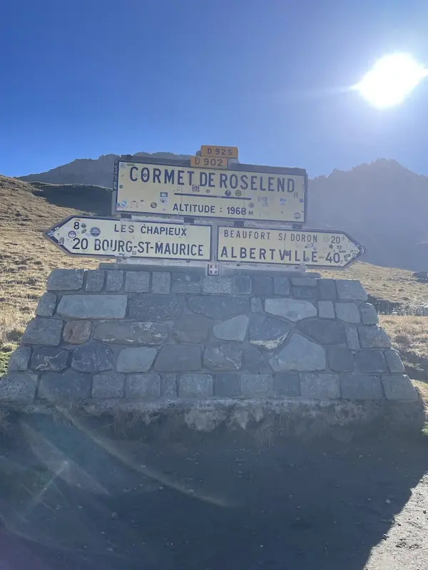
The passage of the Cormet de Roselend marks the culminating point of this early stage. We begin the descent towards Bourg-Saint-Maurice, 19 km long, alternating fast sections and tight turns. The first part is very fast, and often a favorable wind pushes cyclists to impressive speeds.
The turns follow one another, sometimes tricky, requiring constant vigilance. Halfway down, you still have to pedal to get through a series of technical hairpins. This is where Alaphilippe, in 2019, showed the extent of his talent. It was also here in 1996 that Johan Bruyneel, future sports director of Lance Armstrong, had a memorable tumble…
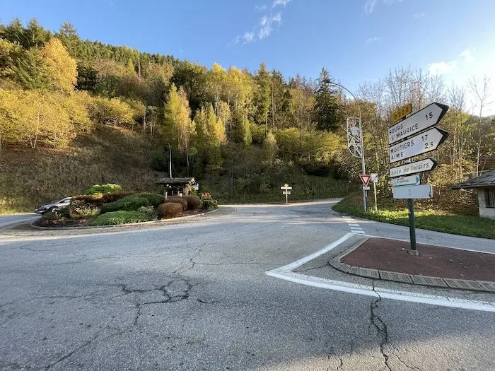
Finally, after this long descent, we reach Bourg-Saint-Maurice and continue our way in the valley with a descending profile for 12 km to Aime, then reach the lowest point, at 675 m altitude.
And then comes the last challenge: the climb to La Plagne
From Aime, a 19.5 km climb awaits you, with an elevation gain of 1,439 m and an average gradient of 7.5%. A pass that reminded me of the Col de la Madeleine on its north side, which the Tour riders will take the day before finishing in Courchevel.
As soon as you leave Aime, the gradient is felt, and your legs are already burning with 114 km on the clock. The climb continues with its numbered switchbacks, a succession of turns on a regular but demanding gradient that pushes you to find a rhythm (a sustained one if still possible!).
The turns follow one another while offering spectacular panoramas of the Beaufortain massif. After 14 km of climbing, the route passes in front of the 1992 Olympic bobsleigh track site, symbolizing the sporting heritage of the place and, above all, the nearing end of this stage.
Here you really feel the end, you can see the resort, almost everything is behind you. The fruit of your preparation will have given you satisfaction, and these last meters will be nothing but joy and happiness, with a touch of suffering… for everyone!
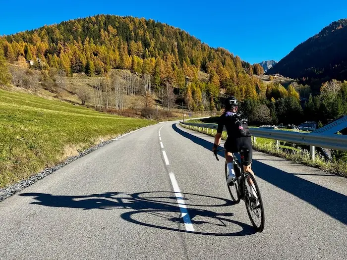
The last kilometers offer little respite, but a welcome flat section allows for a moment to catch your breath. Then, the final ramp rises: a short kilometer at 7% to cross the 2100 m altitude and reach the summit of La Plagne, the end of this 2025 Étape du Tour route.
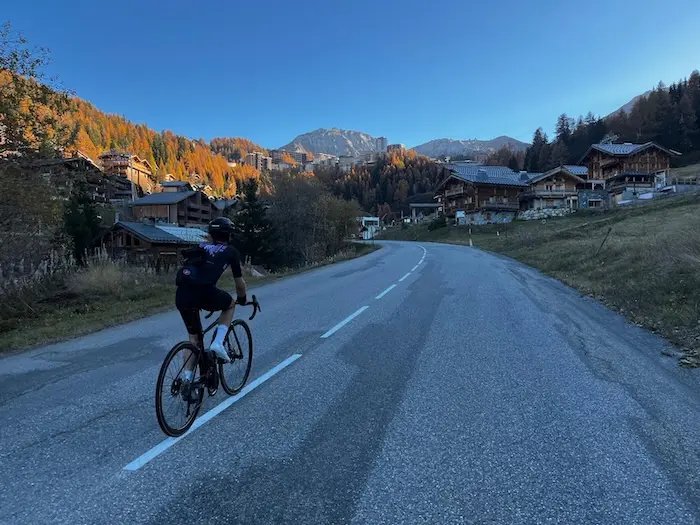
You will have reached the summit, exhausted but proud. An achievement, a unique landscape, and the feeling of having touched the sky, 2000 m in reality – a legendary stage, forever etched in the memory of the Alps, in your memories.
You have nine months of preparation left to reach the mythical resort of La Plagne. In my opinion, this Étape du Tour is one of the most beautiful in recent years, even rivaling the unforgettable Briançon – L’Alpe d’Huez.
It brings together all the great demands of high mountains: first, the difficulty of the gradients, illustrated by the formidable Col du Pré; then, the altitude, with a passage close to 2,000 m at the Cormet de Roselend, and beyond at La Plagne; and finally, the length, because the Pré-Roselend sequence totals 25 km and 1,500 m of elevation gain. The final climb to La Plagne adds a significant challenge with almost 20 km of ascent and another 1,500 m of elevation gain to face.
More details on the route: HERE
This route promises a magnificent atmosphere, in the heart of the Alps, with short valleys and few transitions, sometimes challenging and difficult to grasp on other stages. If you are well prepared for mountain challenges, this stage might even prove easier to manage than last year’s between Nice and the Col de la Couillole.
Share the post "Reconnaissance of the 2025 Étape du Tour between Albertville and La Plagne"