Share the post "Reconnaissance of the 2024 Étape du Tour between Nice and the Col de la Couillole"
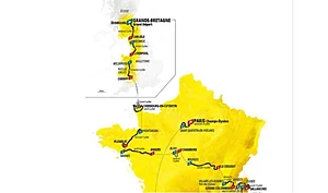
After a first missed appointment due to Covid in 2020, Nice, the capital of the Alpes Maritimes department, returns to the forefront in 2024 by hosting the Étape du Tour, the major cyclosportive event. The route of the 20th stage of the Tour de France, which the cyclosportive will follow almost two weeks earlier, will link Nice on the Mediterranean coast to the Col de la Couillole, covering 138 km with 4600 m of elevation gain. Despite some roadworks in the Turini, we reconnoitered the route the day after its official presentation.
By David Polveroni – Photos: DR / Images: ©ASO

138 km and 4600 m of elevation gain: we are looking at a distance/elevation ratio typical of high mountain stages. More than 30 km less than a famous Marmotte, with barely 400 m less positive elevation gain… This gives you an idea of the difficulty awaiting you on July 7 for the 2024 Étape du Tour. The 2022 event between Briançon and Alpe d’Huez offered the same style of route (with 30 km more!) but featured longer ascents and more time at altitude…
Route: HERE

A start from the Mediterranean coast
The start in the outskirts of Nice will undoubtedly be fast. Even if the gradient is gentle, it’s there from the very first hectometers. The Col de Nice, which comes after 15 km, marks the beginning of hostilities. We take the small road to Blaussac to climb for 4.5 km. Up front, riders won’t leave the large chainring, but you have to manage your effort quickly because this is a grueling course! Then, you’ll find a very short descent, and no time is lost. At L’Escarène, we are already in the Col de Braus.


The Col de Braus
The Col de Braus is 10 km at an average of 6.2%, but we are far from a regular climb like the Lautaret, for example. Here, right after Touet de l’Escarène, you’ll find sections at 8/10% that will inevitably force you onto the small chainring. Depending on your level and pedaling style, a 34-tooth chainring could be interesting on this true (high!) mountain course. You need to find the right tempo quickly. This climb remains rideable, however, with small flat sections. Halfway up, for example, before tackling a series of switchbacks.

These mythical switchbacks of the Col de Braus have been largely neglected by the Tour. Before the war, they were regularly used, with 27 passages, and after the war, there were only two passages. Keep in mind that the hardest part comes 2 km from the summit. After yet another right-hand bend, the small reddish wall: 14/15% for a few meters will glue you to the ground. A beautiful straight line that, in full sun (it really is always sunny in the south!), can quickly become agony. But as a starter at this hour, you grit your teeth and bear it! As the legendary René Vietto, the local rider, winner of the Sospel loop in 1931 at the age of 16, used to do. We will then remember that “King René” was one of those riders capable of a stage victory on the eleventh stage of the Tour in 1934 and winning the mountain classification and four stages dominating the Alps. We will pass his stele after glancing to the right 2 km before to admire the legendary series of hairpins much appreciated by Monte Carlo Rally drivers. But we still have a few kilometers on this special stage…

30 km covered at the summit of the Col de Braus, marked by a small flat section for 500 m before descending, this time, into what is called the Nice hinterland. The turns follow one another, about twenty hairpins, in three series, and the last three kilometers lead us to the small commune of Sospel. No time to admire the trompe l’oeil facades, as we must already climb back up along the Bevera, this river that originates higher up at the Col de Turini.
The Col de Turini
This climb also awaits us. 3 km of downtime, and the Turini already looms before us. An ascent broken down into two parts.

First, the initial section up to Moulinet. 7 km with gradients that allow you to apply what the town dictates: 4 to 6% maximum, spinning the legs a little is a necessity here. We’ll leave the bridge-staircase, reminiscent of the Great Wall of China (miniature version), marking the end of these Piaon gorges, to then arm ourselves with watts and tackle the thirty hairpins up to the Col de Turini. 3 km of flat after the village, then 12 km of steady climbing winding through the forest on modest slopes between 6 and 8%, except for the last 2 kilometers at a little less than 5% to finish the climb peacefully.

“Peacefully” is a strong word! On a reconnaissance where you can take your time, yes, the tranquility of the place is very present here. In July, your heart will be anything but tranquil.
Along these 24 km and 1260 m of elevation, you will have to have managed your nutrition so as not to have exhausted your strength too much, like the Colombians Bernal and Quintana on Paris-Nice 2019, struggling on the descent side of our climb on the slopes of the Nice giant (that’s what we could call it!): we are on the longest climb of this stage!
Here, at 1608 m altitude, you logically know how the rest of your Étape will unfold. If you have perfectly managed these first 66 kilometers, if you feel that you still have something left in the tank, that’s the subtlety of the experience, which will determine whether this turns into a calvary or a second half that will be pure joy.
A very long descent then, over 16 km, anything but restful. It twists and turns in all directions, just like the climb, with hairpin bends one after another. We’ll catch a glimpse of the village of La Bolène Vésubie, a perched village, almost falling into the Vésubie valley. A valley we reach after a total of 80 km after leaving Nice. We turn right and head straight towards the Colmiane ski resort.
The Col de la Colmiane
The Colmiane, sometimes called Col Saint Martin, is a somewhat treacherous climb. This pass doesn’t really climb much until Saint Martin de Vésubie. Its position in the event makes it a formidable climb, even though it doesn’t look it on paper! This is a crucial section for drinking and eating to best approach the end of the race. And when I say “end,” I don’t mean the end of the Colmiane, because here it’s already too late; you should have managed your Turini and its descent. The end: Col de la Couillole. But we’re getting there.

Before that, you have to fight for nearly 9 km of steady climbing between 6 and 8% to take us up to 1506 m at the Colmiane resort, crossed only four times by the Tour de France, the last time in 2020, with Benoit Cosnefroy in the lead.
We then descend into the Tinée valley this time! Still well-focused, with another 16 km of descent, but this side requires fewer brake applications than the Turini. The curves are easy to anticipate, and there are few hairpins. The central part is quite fast, and we then emerge along the Tinée, heading north after a 180° turn.
5 km of transition, on this flat or false flat leading to the Col de la Bonette. We’ll save the Bonette for another day and stick to the roads well-supervised by the Republican Guard and car-free: that’s the Étape du Tour adventure, experiencing for a day what the pros feel for three weeks.

Hitting the wall on the climb: that’s mainly what you’ll feel here, at St Sauveur sur Tinée. We’ll then take a very small road to the left, which descends for 200 m before truly feeling like we’re on another planet.
The Col de la Couillole: the culminating point, the final touch!
The foot of the pass, carpeted on the mountainside with red schist stones, gives you the impression of being in Colorado. No, here, we are in the south of the Mercantour, on the lands of the Mercantour Classic. YOUR story is written on this last appendix, the Couillole, with almost 16 km, it will have enough in 1000 m of elevation gain to make you understand if your training has been up to the event.

The FFC will guide you with their experience and the services normally offered to professionals, to successfully complete your final preparation. They offer you, over five days, to scout, to give you the best advice to manage and approach your July 7th as best as possible.
See: HERE
In short, a mental digression (yes, you think a lot on the bike) but here, management is forgotten kilometer by kilometer. You unleash your last forces, your last sparks of energy, you tear your eyes away from the watts you’ve been maintaining to then push yourself to follow the rider in front of you, you feel that little thrill gradually invading you because at that moment you know it! You know that you will then be a finisher of this stage!
138 km, 4600 meters of elevation gain swallowed, from the first to the last, the feeling of accomplishment must resonate within you!
What to remember from this 2024 Étape du Tour route:
- Straight into the action after 15 km
- The first two descents are not very restful, with a lot of braking and little gradient. So it’s harder to refuel, and less chance to relax
- The Col de la Colmiane is a real challenge due to its placement in the event, even though it looks “easy” on paper
- Fuel management is very important because it’s relentless: a “nervous” Étape du Tour!
=> SEE ALSO: All our Travel articles
Share the post "Reconnaissance of the 2024 Étape du Tour between Nice and the Col de la Couillole"