Share the post "PROS – The route, profile and details of Giro Stage 17, with a summit finish at Sega di Ala"
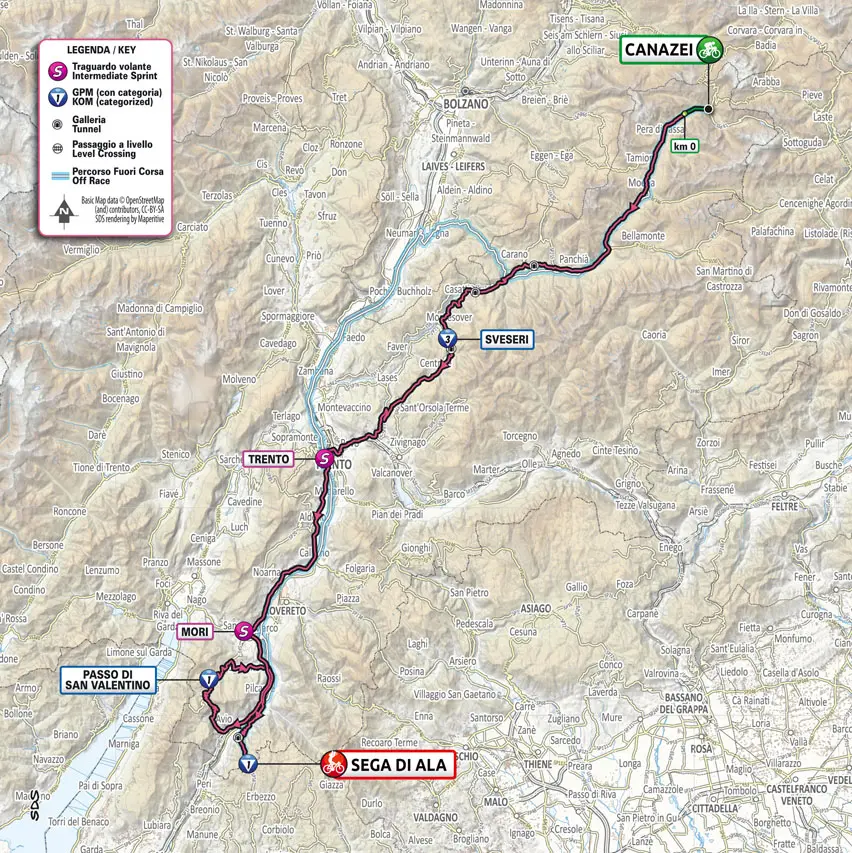
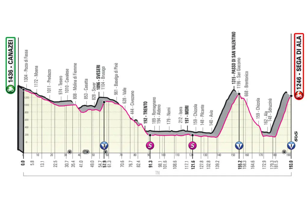
Discover the map, profile, and details of the two climbs on Stage 17 of the Giro d’Italia, between Canazei and Sega di Ala, covering a distance of 193 km. The final climb is 11.2 km long with an average gradient of 9.8%, a maximum gradient of 17%, and will take riders to an altitude of 1246 m.
Images: RCS Sport


Share the post "PROS – The route, profile and details of Giro Stage 17, with a summit finish at Sega di Ala"