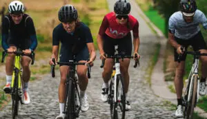
Guadeloupe is a little piece of paradise, over 6,000 kilometers from mainland France, accessible by an 8-hour flight. An ideal training ground for cyclists and triathletes.
Text and photos: Sylvain PIGEAU
Nicknamed Karukera by the Amerindians and the island of beautiful waters, the archipelago is made up of five islands. Grande Terre, Basse Terre, Marie Galante, La Désirade and Les Saintes. Yes, Basse Terre and Grande Terre are two distinct islands, separated by two bridges (La Gabarre and L’Alliance). They are also distinguished by their atypical terrain.
Grande Terre is a dry island, swept by winds and covered with sugarcane fields (the harvest takes place from February to June, so watch out for large tractors transporting the cane). To the north, on the Atlantic coast, there is a landscape resembling the cliffs of Brittany and Normandy. Sometimes deserted, the seaside is magnificent and topped with large limestone cliffs.
Basse Terre, on the other hand, is mountainous, home to a thick tropical forest that acts as the true green lung of the area. Very well preserved, it contains the island’s only volcano, La Soufrière, the highest point in the Antilles (1467 m). There are a multitude of trails and hikes around it. To climb to the crater (no danger, the volcano is under constant surveillance), you can park at Les Bains Jaunes and follow the trail. The ascent takes about 1 hour 30 minutes, take precautions, check the weather, and bring rain gear.
There are few roads on this island, the main one being the one that circles it and the other that crosses it, via the Col des Mamelles.
The terrain is mountainous, a paradise for climbers, with gradients regularly exceeding 10%. There are also a multitude of dead-end roads or loops, often paved with concrete, climbing the slopes of the mountain and La Soufrière. They offer absolutely brutal percentages. For example, the climb on the Village section, in Bouillante, is 3 km long and its minimum gradient is 15%!
Across the island, some hills can offer gradients of over 15%.
An Island for Cycling
These small pieces of land, in the middle of the Caribbean, allow you to prepare for your season away from the cold or simply to recharge. The ideal period is from December to March. For cyclists from mainland France, this window allows them to escape and flee bad weather. And on the island, it’s the calmest period. Between April and July, the weather is very hot and humid. Between August and November, it’s hurricane season.
“The ideal period is from December to March.”
Moreover, the mildness of December allows for a stay without suffering too much from the heat. Because from the end of January, the temperature regularly exceeds 30°C, especially from April onwards. The water, meanwhile, varies throughout the year from 26°C to 30°C.
Hikes, water sports, boat trips, culinary arts, historical sites, and a host of things to visit. Distilleries, several museums including the famous “Mémorial ACTe” on slavery, plantations, monuments, and local heritage buildings. Take your time and remember that it’s impossible to do everything in a week!
Then all that’s left is to take your bike out of its travel bag and breathe in the windy plains of Grande Terre or explore the Basse-Terre mountains. In both cases, the landscapes, colors, and scents will leave you with unforgettable memories, in addition to the drops of sweat left on the road!
The tranquility of Pointe-des-Châteaux, at the extreme east of Grande-Terre, is relative. The area is swept by winds and a strong swell prevents swimming.
ROUTE 1: Easy (60 km)
Pointe des Châteaux and a short tour of Grande Terre via Le Moule and Douville (approx. 60 km). Start/finish: Saint-François. Recommended gearing: 39×23 for racers, 34×23 or more for sportive riders.
Let’s start from Saint François for a short tour of the easternmost part of the island. Head towards Le Moule via the long, windy straight road. You will pass by some fruit producers and the colonial house in Zévalos.
Cross Le Moule and exit along the seaside. Exposed to the Atlantic Ocean, there is regularly a strong swell and you may encounter surfers. In the distance, the northern cliffs resemble, to a striking degree, certain coastlines in Brittany or Normandy.
Copyright Sylvain PIGEAU – www.3Bikes.fr
The return journey is via the cross roads through the sugarcane fields. Turn left towards Sainte Anne and Douville, at the “le Shiva” nightclub. Continue straight to Douville, passing through Bel Etang. Upon entering Douville, at the top of the small hill, turn left towards Bérard. All this to avoid the often busy road connecting Sainte Anne to Saint François.
Continue through Saint-Charles and Bragelogne to arrive at Saint-François. At the roundabout, go straight and descend towards Raisins Clairs beach. Pass through the center of Saint François and its beautiful square, then head towards Pointe des Châteaux. You will have no choice but to turn back at the end, but it’s worth it.
Follow the beaches sheltered by the manchineel trees to the point where you will have a beautiful view of the distance and La Désirade. The steep coast is swept by winds and a short walk to the cross offers a magnificent viewpoint over all of Guadeloupe and the archipelago. From sunrise to sunset, the details and colors constantly change, revealing the island’s beauty.
Round trip Deshaies from Baie-Mahault. Recommended gearing: 39×25 for racers, 34×25 or more for sportive riders.
Starting from Baie Mahault, head towards Lamentin and Sainte Rose via the national road. It is possible to make a detour through the village of Lamentin at the start. The first kilometers are through rolling hills and sugarcane fields. Shortly after Lamentin, interesting viewpoints begin to appear. First on the left, towards the mountains, then on the right, towards the Grand Cul-de-Sac Marin. The colors are constantly changing, the landscapes also vary, and the turquoise blue of the sea gives the ride a paradisiacal feel.
The passage through Sainte Rose is just as pleasant; if you have time, let yourself wander through the small streets, near the sea and the small port.
Continue on the road towards Deshaies. The small climbs are a bit of a struggle and require good momentum. At the northern tip of Basse-Terre, near Thillet beach, you will have an unobstructed view of the islets of Kahouanne and Tête à l’Anglais, with the island of Montserrat and its volcano in the background. Admire the white sand beaches that characterize the area and note the presence of the famous Fond Royal hotel, perched on the rocks.
Continuing towards Deshaies, stop at the Gadet viewpoint, overlooking Grande-Anse beach. Then make a stop at the superb village of Deshaies. The calm and colors make up the charm of this small town. At the exit, one of Guadeloupe’s most famous climbs begins: L’Estomac à Frédéric. The road leads towards Pointe Noire and also passes through the very popular climb of Baille-Argent, often a strategic point in the Tour de Guadeloupe cycliste in August. It is possible to push further or even do the loop via Les Mamelles, for the bravest.
For our itinerary, turn back. At Grande Anse beach, you can turn right and climb the terrible ascent of Caféière. A major site for car hill climbs, it has also been the scene of some individual time trials in cycling. Compact or triple chainrings are mandatory to conquer this “morne”! In some bends, the gradients easily exceed 15%!
At the top, you will have magnificent viewpoints over “la Corniche d’or” as well as Grande-Terre in the distance. Begin the descent carefully, then you will rejoin the national road leading to Sainte-Rose and Baie-Mahault.
Tour of Basse Terre via the South. Start/finish: Bouillante. Recommended gearing: 39×28 for racers, 34×28 or more for sportive riders.
This beautiful ride will allow you to discover the Leeward Coast, the volcano, and the only road crossing Basse-Terre via the mountain and its tropical forest.
Your starting point, of course, depends on your accommodation. You can park at the Amédée Detraux Velodrome, a true cycling hub and hive of activity during major events. It is in the center of the island, unmissable, and provides a strategic start and finish location. But for tourism purposes, start from Bouillante. This charming commune is known for its hot sulfur baths, hence its name. Some are very well known, others more secret…
Leave Bouillante in the direction of Pointe-Noire and pass along Malendure beach where diving clubs are lined up in a row. You then have an unobstructed view of the Pigeon islets, which are part of the Cousteau Reserve. This protected area is highly sought after by divers and “eco-tourists.”
In Mahault, turn right and begin the ascent of Les Mamelles. This will take you about 6 km. The steepest gradients are at the exit of Mahault. The climb then becomes much more regular and eases significantly after the Parc des Mamelles.
Pass the summit and admire the viewpoint over the tropical forest. Shortly after the Parc des Mamelles, it is also possible to have an unobstructed view of the rolling hills and the forest.
Be careful on the descent, the turns are very tricky and the gradient leads to high speeds. The sections of Corossol and Bras David are very delicate; there are tourists circulating and the road is often wet. Take your time because it is not uncommon to find branches or various objects on the road due to frequent heavy rains.
At the exit of Les Mamelles, turn right towards Vernou. Descend to Colin, then you will have to take the expressway for a few hundred meters. Immediately exit towards Petit-Bourg. Cross to the Montebello roundabout, then take the direction of Capesterre-Belle-Eau and Basse Terre. This will be the least “fun” part of the journey. Indeed, passing through this busy road is mandatory. As soon as possible, prefer the alternative via the village of Goyave.
In the vicinity of Capesterre, you will see banana plantations on the mountain slopes and have an unobstructed view of Marie-Galante, Dominica, and Martinique on a clear day! Look towards the peaks and you can spot La Soufrière as well as Les Chutes du Carbet. Out of curiosity, you can wander off to follow the sign indicating the direction of Allée Dumanoir. This old road lined with palm trees is one of the region’s postcards.
Continuing towards Basse Terre, you will encounter two serious difficulties, the climbs of Salé and Sapotille. Approximately 2 km each, straight and at an average of about 10%. These are two terrible sections well-known on the island for the confrontations that take place there during the Tour de Guadeloupe in early August. This “mini-Tour de France” is one of the biggest competitions in the Caribbean. Classified as 2.2 UCI, it hosts several continental teams each year and demonstrates that cycling is definitely the number one sport on the island.
On your left, admire the breathtaking view of Les Saintes. The weather is rarely bad and the spectacle is superb. At the top, turn left towards Trois Rivières and Vieux Fort. Along this small coastal road, you will follow the seaside of the southern tip of Basse-Terre. Admire the viewpoint on your left and let yourself be tempted by the charm and tranquility of Trois-Rivières and Vieux-Fort. There are several spots for photo stops, especially at the Vieux-Fort lighthouse. Then continue to Basse-Terre, passing along the seaside and the marina of Rivière-Sens.
In Basse-Terre, take the direction of Baillif and Vieux-Habitants along the seaside by turning left at the roundabout.
Continue your journey towards Vieux-Habitants. Travel along the Leeward Coast and all its small “mornes” (hills). You will have needed to save some energy to return to Bouillante. The last kilometers are particularly physically demanding. Remember to refuel regularly, from start… to finish.
Wild, Basse-Terre is almost entirely composed of dense jungle. Here, at the summit of Les Mamelles.
Travel – Access
The price of a ticket to Pointe-à-Pitre remains substantial. Depending on the period and airline, a round-trip ticket can cost from 300 to over 1,500 euros. Then count 100 euros round-trip for bike transport.
Info
Road traffic is constantly increasing on the island. Be careful, prefer off-peak hours for riding and secondary roads. Also, some road sections have degraded asphalt in places. Opt for solid tires, even if it’s hot.
These routes are indications only. It is necessary to inquire locally about the possibilities of cycling on certain roads due to potential modifications by authorities throughout the year.